
Downloadable maps and analysis
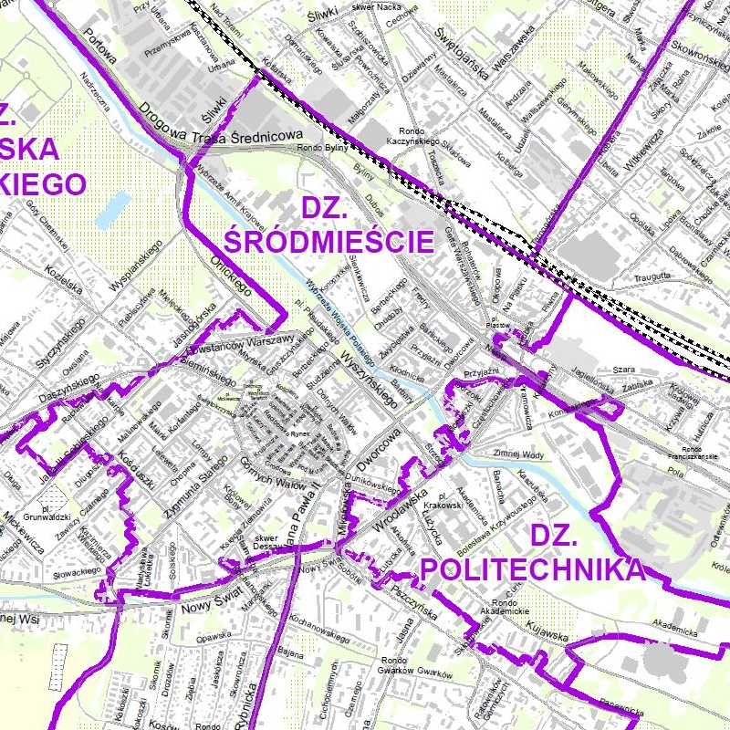
City division into districts
Gliwice map showing the city division into districts. Map base layers: city border, buildings, streets, waters, cemeteries, allotments, agricultural land, grassy vegetation, forests. An appendix to the map is a list of streets by district. The map is available in pdf format.
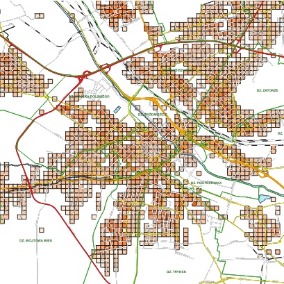
Population density in Gliwice
Map presenting the population density phenomenon in Gliwice. The analysis was made on the basis of PESEL (Population Id No.) data as of 30/03/2026. The map was created in 1:75 000 scale and saved in PDF format.
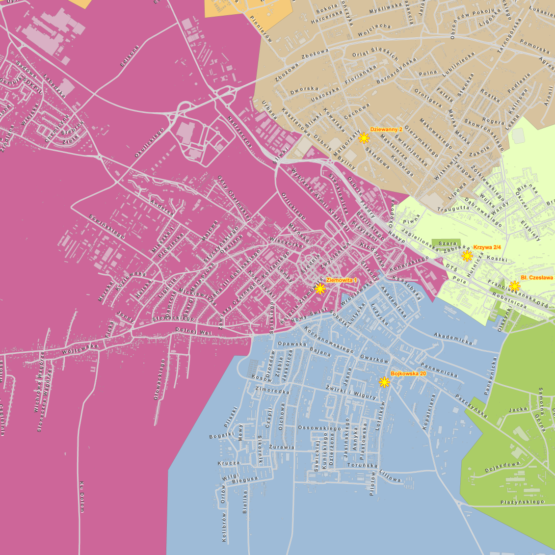
Zoning of Social Welfare Centre branches
Zoning Social Welfare Centre in Gliwice branches. The map was created in 1:18 500 scale and saved in PDF format.
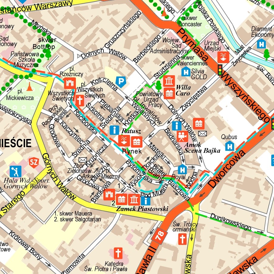
The City of Gliwice colour plan in 1:25,000 scale
The information content consists of public facilities, sports facilities, cultural facilities, monuments, tourist trails, bike paths, hospitals, emergency services and other. The centre enlargement to 1:10,000 scale and a legend are extra elements.
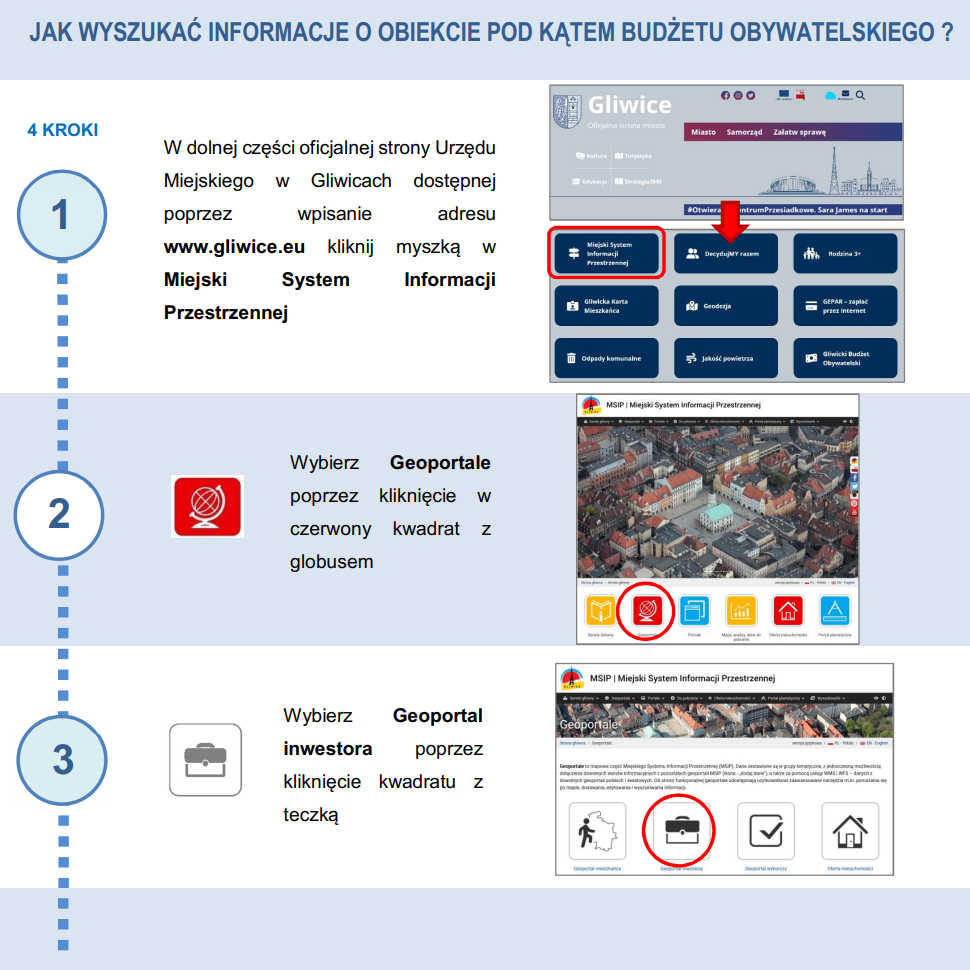
Object information – Instruction
Instruction – how to find information about an object (e.g. a plot of land) as quickly as possible.
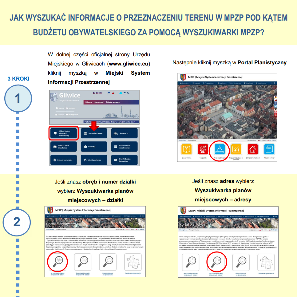
Intended use in MPZP – instruction
Instruction – how to find land use information in the MPZP as quickly as possible.