
Services and data
Spatial data services
Web Map Service (WMS)
Web Map Service (WMS) data is a service which consists in sharing map pictures for external applications/websites. If you have such application at your disposal, you do not need to directly use the geoportal. You can enter WMS service address in it. Your application will automatically connect to ISDP server, which will share a current map each time.
The WFS service can be used to retrieve datasets such as:
- Urban Spatial Information System
https://geoportal.gliwice.eu/isdp/gs/ows/wms - Land and Buildng Register, land development networks, geodetic grid
https://wmswfs-geodezja.gliwice.eu/iip/ows - Ortofotomaps
https://geoportal.gliwice.eu/isdp/gs/ows/wms2 - Studium Uwarunkowań i Kierubków Zagospodarowania Przestzrennego (SUiKZP) oraz Miejscowe Plany Zagospodarowania Przestrzennego (MPZP) - obowiązujące
https://geoportal.gliwice.eu/isdp/gs/ows/wms3
Web Feature Service (WFS)
Web Feature Service (WFS) data is a standard for exchanging spatial data over the Internet defined by the OGC (Open Geospatial Consortium) and provides a simple HTTP interface to display or download spatial data in vector form that has a defined geographic coordinate system. WFS is based on client-server architecture and relies on the spatial data server's response to the client's request for data stored on the server. The result of such an operation is the downloading and displaying of data by Customer's “browser”. Data are downloaded in the GML format and can be used in desktop GIS software (Geographical Information System), as well as in software tools.
The WFS service can be used to retrieve datasets such as:
- Street network, address points, city border, district borders
https://geoportal.gliwice.eu/isdp/gs/ows/wfs-dane - Study of spatial development conditions and directions (SSDCD)
https://geoportal.gliwice.eu/isdp/gs/ows/wfs-suikzp - Local spatial development plans (LSDP) – binding
hhttps://geoportal.gliwice.eu/isdp/gs/ows/wfs-mpzp
Downloadable data
Data in CSV format
Data in SHP format
Downloadable maps and analysis
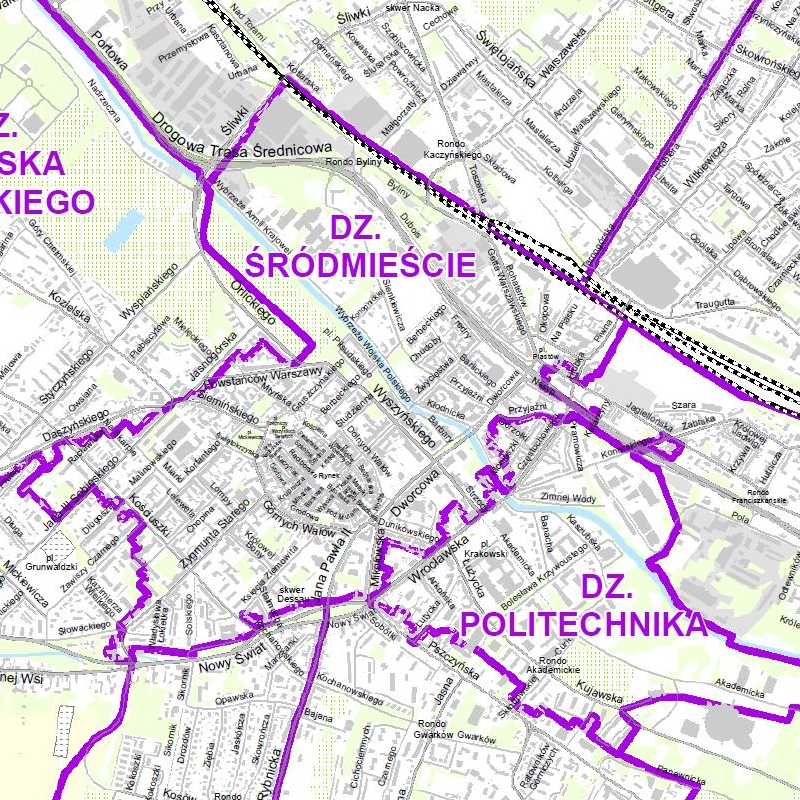
City division into districts
Gliwice map showing the city division into districts. Map base layers: city border, buildings, streets, waters, cemeteries, allotments, agricultural land, grassy vegetation, forests. An appendix to the map is a list of streets by district. The map is available in pdf format.
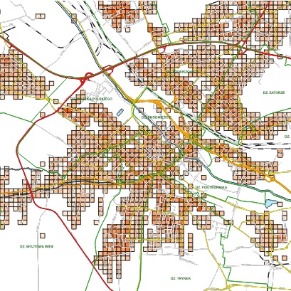
Population density in Gliwice
Map presenting the population density phenomenon in Gliwice. The analysis was made on the basis of PESEL (Population Id No.) data as of 30/03/2026. The map was created in 1:75 000 scale and saved in PDF format.
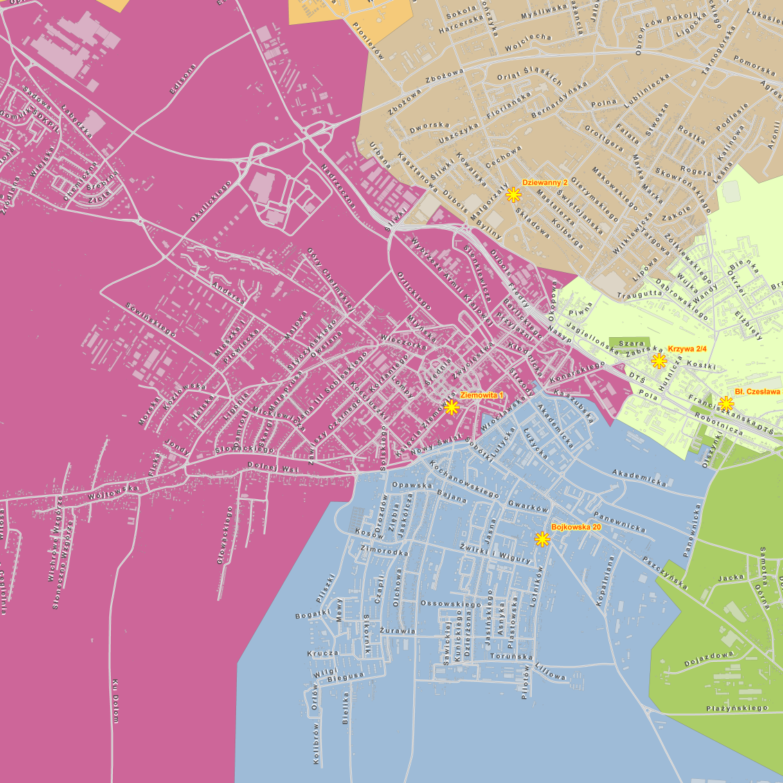
Zoning of Social Welfare Centre branches
Zoning Social Welfare Centre in Gliwice branches. The map was created in 1:18 500 scale and saved in PDF format.
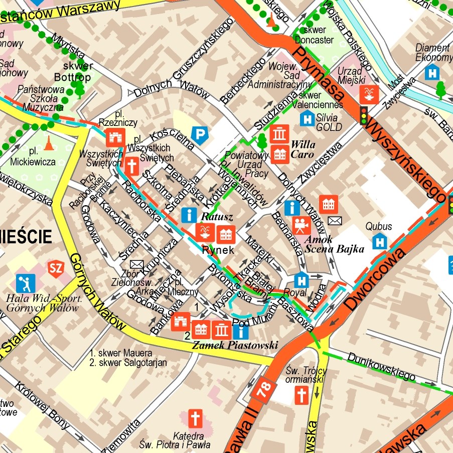
The City of Gliwice colour plan in 1:25,000 scale
The information content consists of public facilities, sports facilities, accommodation base, cultural facilities, monuments, tourist trails, bike paths, hospitals, emergency services and other. The centre enlargement to 1:10,000 scale and a legend are extra elements.
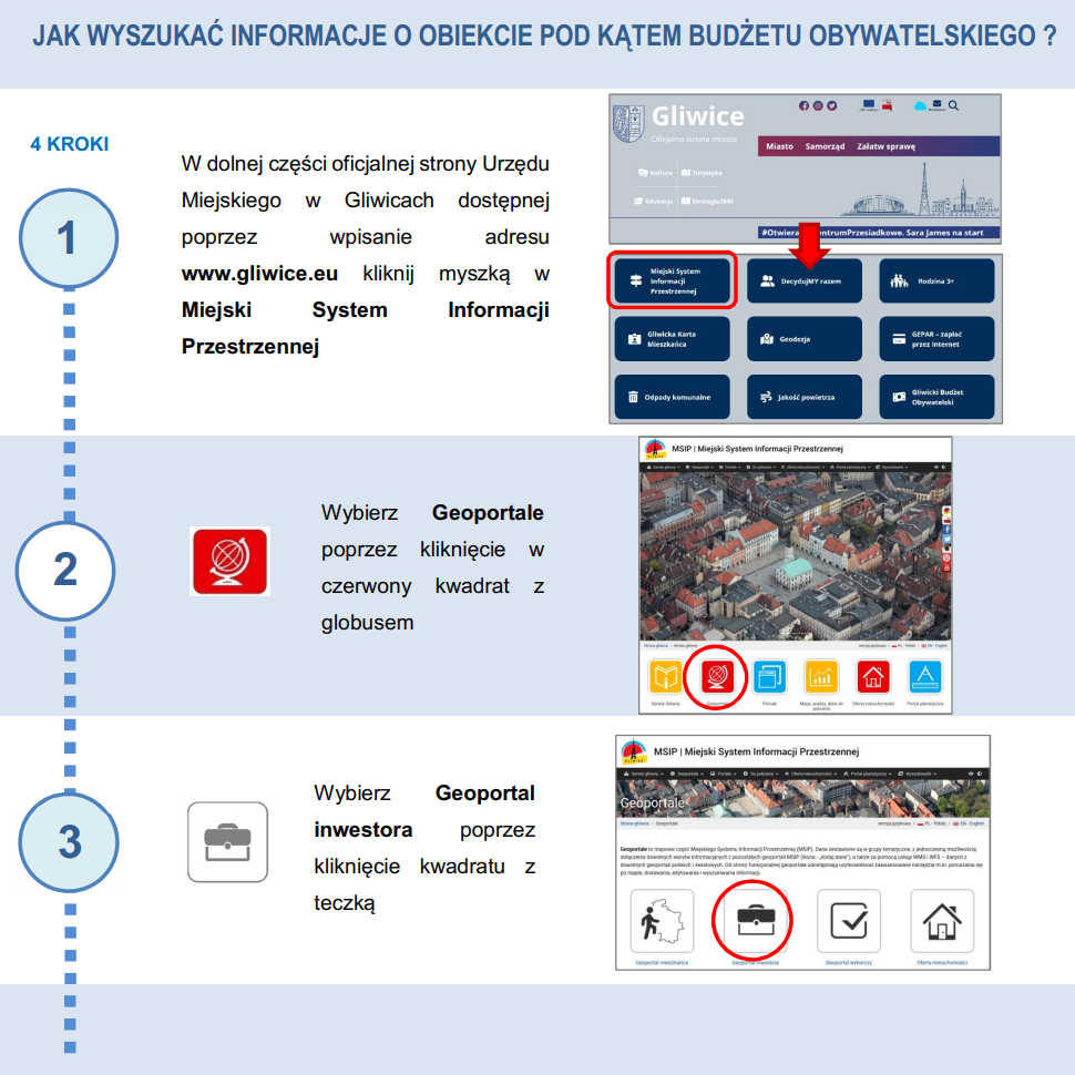
Object information – Instruction
Instruction – how to find information about an object (e.g. a plot of land) as quickly as possible.
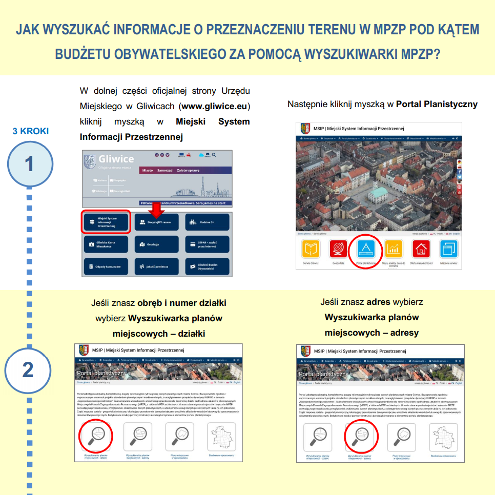
Intended use in MPZP – instruction
Instruction – how to find land use information in the MPZP as quickly as possible.